Falmouth is the home of
MEI, and was recently voted the best place to live in south-west England. Personally there is no other place in the world that I would rather be, and this stretch of the Cornish coast path I have walked countless times, often with
MEI Conference delegates, but never tire of it. It is not a typical coast path walk, in that it is all on paved pathways, but nevertheless is one of the easiest and most rewarding of Cornish walks.
Falmouth lies between two beautiful rivers, the Helford to the south and the Fal to the north and after walking over the cliffs from the Helford River, crossing Falmouth's most southerly beach at Maenporth (posting of
10th April 2015) we arrive at Swanpool Beach and the start of the 4.3 mile leisurely stroll to the River Fal and the border between west and east Cornwall.
 |
| Swanpool Beach |
 |
| Early print of the old Swanpool Mine |
Although there is little evidence of it now, there was a lead-silver mine at Swanpool in the mid-19th century, and arsenic was also recovered by calcining, the remains of the arsenic works being visible on the cliffs to the west until being grassed over early this century. Pennance Point to the west, where the fumes were discharged, is still known locally as Stack Point.
Before leaving Swanpool Beach, cross the road and take a look at the lovely small lake, from which the beach takes its name. Swanpool, a reserve to an abundance of birds, is fed by the little Bickland stream, and overflows into the sea via a culvert under the road.
 |
| Swanpool |
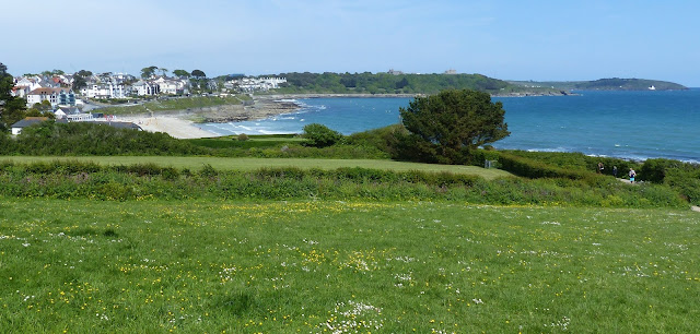
When leaving the beach take the upper path and walk across Boscawen field with its great view of Falmouth's main beach, Gyllyngvase, and the distance docks and castle.
 |
| Boscawen Field |
 |
| Gyllyngvase Beach |
Gyllyngvase Beach marks the start of Falmouth's beautiful mile long Victorian promenade, which passes the lovely Gyllyngdune Gardens and the Princess Pavillion, where on balmy summer evenings it is worth stopping for a beer and listening to the brass band playing in the Edwardian bandstand.
 |
| Strolling along the 'prom' |
 |
| The promenade in Edwardian days |
 |
| Metamorphosed Devonian sediments at Castle Beach |
Castle Beach at the end of the promenade is a favourite for locals, as children love to explore the many rock pools at low tide. And if you are interested in geology, take a look at the rocks on the beach. They are over 400 millions years old, some of the oldest rocks in England. They were originally laid down as sandstone and silt sediments in the Devonian era, and remained undisturbed as horizontal strata for over 100 million years, until they were uplifted and deformed by the tremendous pressures of tectonic plates coming together in the final phase of the formation of the supercontinent Pangea. This uplifting produced the Variscan mountain range, the eroded remnants of which are America's Appalachians, the Urals, the Pyrenees, and, in SW England, the high moors of Dartmoor and Bodmin. This unimaginable tectonic pressure also partly melted the underlying mantle, which eventually solidified into a giant granite batholith, which underlies most of Cornwall, outcropping in several areas. The hot granite baked the deformed sediments into a hard metamorphic rock known locally as
killas, which cracked as it cooled, allowing mineral laden waters to rise from the mantle, and crystallise in the cracks. In many parts of Cornwall tin and copper minerals crystallised, while in Falmouth you will see white quartz crystallised into these cracks.
 |
| Pendennis Castle |
The promenade takes us to the scenic Castle Drive, leading to the Pendennis Headland and the estuary of the River Fal. The 16th century Pendennis Castle (
posting of 4th April 2012) dominates the headland, and on the tip of the headland itself is the Little Dennis blockhouse, built as a look out post during the construction of the main castle. The blockhouse overlooks the estuary and the wide expanse of water known as Carrick Roads, which separates Falmouth from the Roseland peninsula, and the village of St. Mawes, which also boasts its own 16th century castle (
posting of 20th September 2014). Both castles were built to guard the estuary and the access to the old town of Penryn.
 |
| MEI Conference delegates by the Little Dennis Blockhouse, overlooking Carrick Roads and St. Mawes |
The Carrick Roads waterway was created at the end of the last Ice Age when sea levels rose dramatically and created a huge natural harbour. The Carrick Roads take the form of a classic
ria, or drowned river valley, and is dominated by a deep, meandering channel, navigable all the way from Falmouth to Truro. The channel, the ancient River Fal, is navigable by very large vessels, and is up to 35 metres deep, but the banks rise steeply to depths of only around 10 metres.
From the headland the best route is up via the Coast Guard Station to the castle's dry moat, passing some of the large guns which were positioned on the headland during WW2.
 |
| Pendennis Castle moat |
From the moat we arrive back on Castle Drive and the great view of Falmouth's huge ship repair docks, perfectly situated in the world’s third largest natural deep water harbour.
 |
| Castle Drive and Falmouth Docks |
From the docks it is a short walk into Falmouth town, passing the docks railway station, the terminus for the Maritime Line from Truro, which was opened in 1863. The area from Events Square, home of the Maritime Museum, and on to Arwenack Street, has some of the world's finest
eclectic restaurants, as well as some great pubs, including the
Chain Locker on Customs House Quay, the venue for most of the
Cornish Mining Sundowners and a final watering hole for
MEI Conference delegates after their guided coastal walk.
 |
| Al Fresco Restaurants, Events Square |
 |
| Customs House Quay and the Inner Harbour |
Falmouth's bustling town centre stretching almost a mile from Arwenack Street, to Market Street and the High Street, has a whole range of shops and art galleries, and many coffee and pasty shops.
 |
| Market Street, leading to the High Street on the right |
Just before the High Street is the Prince of Wales Pier, the border between West and East Cornwall, with its great views across the Penryn River to the tiny village of Flushing. From here ferries leave for
St. Mawes and the Roseland Peninsula.
 |
| Prince of Wales Pier |
 |
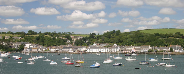
| The view from the Prince of Wales pier, across the Penryn River to Flushing |
More Cornish Walks


No comments:
Post a Comment
If you have difficulty posting a comment, please email the comment to bwills@min-eng.com and I will submit on your behalf